A Fountain on the Fringe & The ‘London Waye’
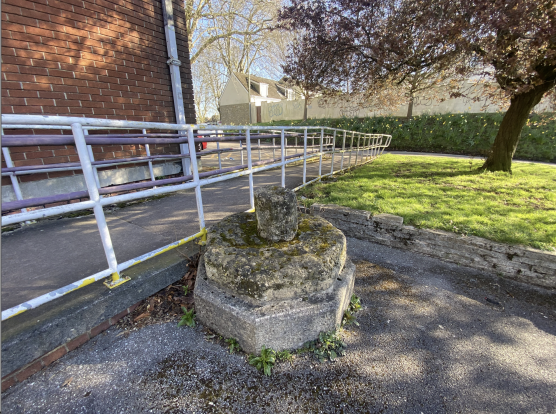
In St George, the worn remains of a medieval relic sit in the car park of the library. It’s now an accidental bollard, guarding the metal railings of the library access ramp.
On one of those early spring days we’ve been lucky to have these past few weeks, I set out on my usual loop: from my house just off Church Road to Avonview Cemetery, through the Strawberry Lane allotments, up Troopers Hill, then back down across Church Road—past the fountain and onwards toward the park. Parents pushed prams up to the library for a reading group, while the steady hum of Church Road rumbled in the background.
As I admired the bank of bright yellow daffodils facing the library, I noticed something I’d never seen before: an octagonal slab of mossy stone sitting in a car parking space. A rough, unshapely nub protruded from its top, signifying where it once supported something high and mighty.
The stone is the size of a large parasol base and is called ‘Don John’s Cross’—a fact I learned as I scrolled through Kingswood and East Bristol articles on my phone later in the park.
They are the remains of a medieval high cross or ‘preaching’ cross. They dotted the medieval world, around them folks gathered to meet, to learn, and to hear the word of God spoken in public. According to the Bath and Avon Family History Society, St George actually grew out of a hamlet named ‘Don John’s Cross’ after this little treasure.
Before its resting place in the library car park, the cross stood where the Victorian drinking fountain stands now on Church Road, at the fork of Bell Hill and Summerhill Roads.
We have no evidence to tell us where this peculiar name came from, but the abiding theory is that it derives from the name of a Spanish nobleman. According to a Historic England archive entry: “The legendary tale attached to this cross is that the corpse of Don John (perhaps Domini Johannis), a noble Spaniard rested here on the way to its place of internment, probably in Spain, from the port of Bristol".
Apart from our stone, there is only one remaining remnant of ‘Don John’ in the nomenclature of the area: Don John’s House, a block of apartments on the former site of a George’s Brewery pub. This pub was also called the Don John’s Cross, near the old Fountain Cafe (now a tattoo parlour).
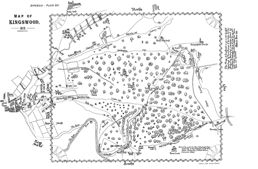
Our octagonal Don John monolith once marked the end of Bristol and the beginning of the King’s Wood. It was a meeting point of the East Bristol Fringe, a crossroads connecting St George, Redfield, Hanham, and Kingswood. This same geographical marker was replaced by a Victorian drinking fountain, one of many across Bristol.
Drinking fountains have always demarcated urban space. In most places, where you see a fountain, you will see a point in a crossroads or focal point. Of course, a lot of the time, this relates to a convenient spot where a spring or well once flowed. The central fountain of a square in Bristol, Paris, or Jerusalem was once the meeting point of areas, villages, or roads—where people came to rehydrate, to meet, to talk, to preach.
The King’s Wood is where King John reputedly hunted during his leisure visits to Bristol—or back then, Brigstowe (place of the bridge).
Our point in St George represented—and still can, if you like—the symbolic gate to London for many: the ‘London Waye’.
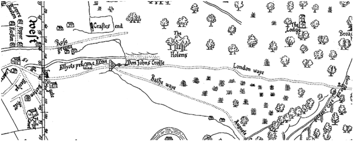
This is a route which you could still walk today, along some canals, beautiful countryside, and hefty main roads. Before the M32, the M4, or Leigh Delamere (and long before petrol stations and Greggs), this was an ancient route from Bristol to London, out into the woods, and east.
If you look at a map today, heavy machinery and our modern ability to destroy and construct motorways just about anywhere is obvious. The M32 and M4 jut out of the city at counter-intuitive angles, slicing Bristol in two before heading miles north into Gloucestershire, then diverting eastwards to Swindon, going through three counties in the first fifteen minutes.
Our route from the point of Don John’s Cross, however, follows the organic paths of the terrain. People’s feet and hooves naturally embedded tracks along river valleys and sheltered woods. This waye stretched from the western fringe of London, the ‘Home Counties’, across the Wessex Downs, and to Somerset for millennia.
Coming from the east 500 years ago, one of your first glimpses of the city of Bristol down below would have been at the top of the hill beside the Don John Cross.
Just as today families gather in the library or park, this point would have been the site where loved ones accompanied each other to the edge of the city before a long journey to London.
As I walked back past the ruined cross to return home another spring evening, a delivery van pulled up into the space, avoiding a head-on collision by a half a metre. The irony, I thought, that this relic that has marked a waypoint in someone’s journey for hundreds of years is now in a parking space. The daffodils were on the turn, turning their paler yellow. I wondered how many seasons the flecks of mess on the cross had seen, and if it will ever be moved again to another angle of Bristol curiosity, another crossroads.
Written by George Leith


Recipes